
Puerto Rico · Southwest · Coast and salt flats
What to see and do in Cabo Rojo
Cliffs, birds and salt landscapes.
A destination to explore the southwest landscape between the Los Morrillos Lighthouse, La Playuela and the coastal habitats of the Salinas.
Duration, budget and itinerary: editorial suggestions adjustable to your trip. No prices or availability in real time.
What to visit in Cabo Rojo
PLACES AND EXPERIENCES
What to do in Cabo Rojo
heritage
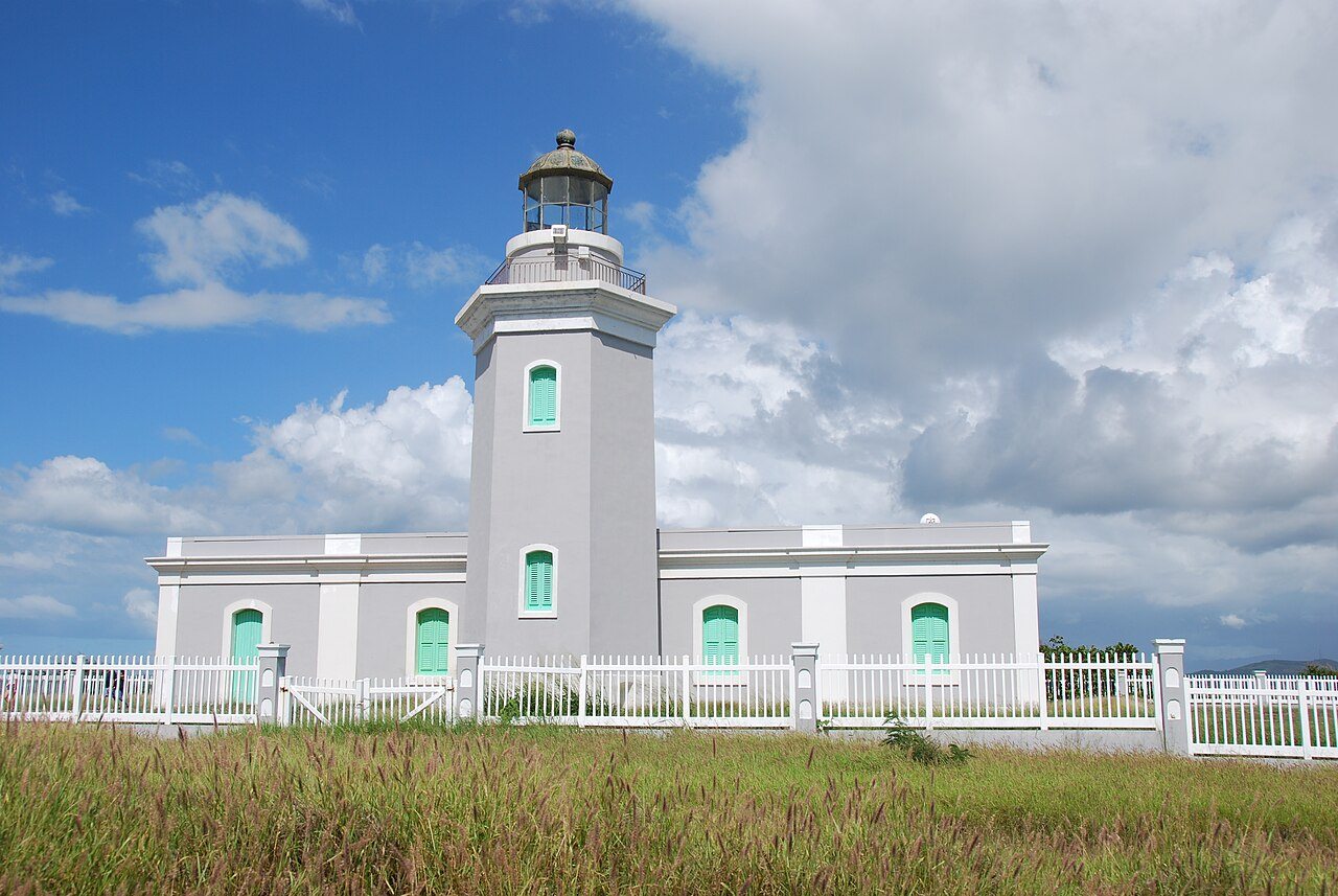
Los Morrillos Lighthouse
A lighthouse on limestone cliffs that is part of the landscape of the extreme southwest of Puerto Rico.
Activities for your visit
- Observe the lighthouse from the authorized visiting areas.
- Take in the views of the coastline while staying on the permitted trails.
Tips for this place
- Check road conditions and access before leaving.
- Keep distance from the edges of the cliffs and respect the signs.
Check the road and open areas before visiting. The outdoor walk does not guarantee entry to the building or tower; confirm any interior visit with the administrator. Stay on the trails and keep away from cliff edges.
Reference sources and location
Spot the lighthouse building, not the parking lot or trailhead.
Reference coordinates: 17.9336161, -67.1922253.
OpenStreetMap · Los Morrillos Lighthouse · © OpenStreetMap contributors · ODbL
beach
La Playuela · Playa Sucia
A beach in the area of Los Morrillos, surrounded by a coastal landscape without a strip of beachfront hotels.
Activities for your visit
- Walk along the coastal areas and contemplate the landscape.
- Combine the visit with the surroundings of the lighthouse if access allows it.
Tips for this place
- Parking is limited: confirm logistics and avoid blocking access.
- Carry what you need for the day and remove your waste; Check the state of the sea before entering the water.
Visit the beach independently using the authorized road and access areas. Parking is limited and beach facilities are not guaranteed. Arrange transportation and distinguish beach access from an interior visit to the lighthouse.
Reference sources and location
Reference to the beach area, not the parking lot or an entrance to the water.
Reference coordinates: 17.935521, -67.1890421.
OpenStreetMap · Playa Sucia · © OpenStreetMap contributors · ODbL
nature
Cabo Rojo Refuge · Salinas sector
A sector of the refuge with salt flats, coastal habitats and opportunities for landscape interpretation and bird watching.
Activities for your visit
- Observe birds from authorized spaces and trails.
- Consult the visit to the interpretive center and the observation tower of the sector.
Tips for this place
- FWS reports construction and temporary closure of the road to the main headquarters: confirms access to the Salinas sector, which is different.
- Stay on the permitted routes and avoid entering the lagoons or disturbing the birds.
Visit the Salt Flats Unit trails, tower and interpretive center during FWS opening hours. This is separate from refuge headquarters, whose road is temporarily closed for construction. Ask the refuge about guided tours, groups or activities requiring authorization.
Reference sources and location
Orientative reference for the Salinas sector; It does not locate the main headquarters under construction or the exact entrance to the interpretive center.
Reference coordinates: 17.9595518, -67.187233.
OpenStreetMap · Salinas · © OpenStreetMap contributors · ODbL
A PROPOSAL TO ORGANIZE YOURSELF
2-day itinerary in Cabo Rojo
- Day 1
Cape landscapes
Combine the surroundings of Los Morrillos with La Playuela, depending on road conditions and which access routes are open.
- Day 2
Las Salinas and its birds
Check with the shelter about the possibilities of visiting the Salinas sector and its interpretive spaces.
Tips for visiting Cabo Rojo
- Check the roads and sectors enabled with FWS: access to the refuge's main headquarters has a temporary restriction due to construction.
- Organize road trips and bring water and what you need for a visit to the outdoors.
LOCAL FLAVORS
What to eat in Cabo Rojo
From a mofongo by the sea to the flavors of a family table. Discover a part of the island through its cuisine.
Puerto Rican cuisine
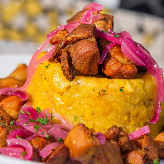
Mofongo with fried meat
Fried green plantain mashed with garlic, accompanied by fried meat. A combination of flavors and textures of Puerto Rican cuisine.
Reference: Discover Puerto Rico
Tradition of the entire island
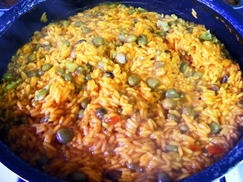
Arroz con gandules
Rice cooked with pigeon peas and sofrito. Traditional recipes may include pork or ham.
Reference: Discover Puerto Rico
The celebration table
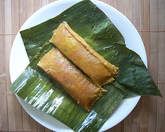
Pasteles
Viand or banana dough with filling, wrapped in banana leaves and cooked boiled.
Reference: Discover Puerto Rico
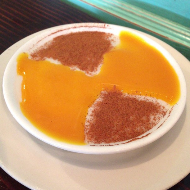
A sweet and Puerto Rican ending
Tembleque
Creamy coconut dessert, usually finished with cinnamon. A traditional flavor to close the meal.
Reference: Discover Puerto Rico
Sources to prepare your visit
Reference location: GeoNames · Cabo Rojo.
Editorial content by SoyTurista PR, based on the linked sources. Confirm details with each provider before traveling.
Report a change to this guide. Include its URL and an official source if available.
Continue discovering Puerto Rico
Check out more guides and combine places that fit your interests.
All Puerto Rico guides →